How Many People Died In The 1886 Eruption Told On The Crater Walk
The 1886 Tarawera eruption killed more than 100 people in villages near the mountain. A plain account of what the record states, and how the story is told on guided trips.
More than 100 people were killed in villages near the mountain on the night of 10 June 1886. That figure comes from GNS Science, New Zealand's geoscience institute, and it is the number careful writers stick to. Older books and newer websites give different exact totals, because counting the dead in 1886 was hard and the records were themselves destroyed. What holds across them is the plain figure: more than 100.
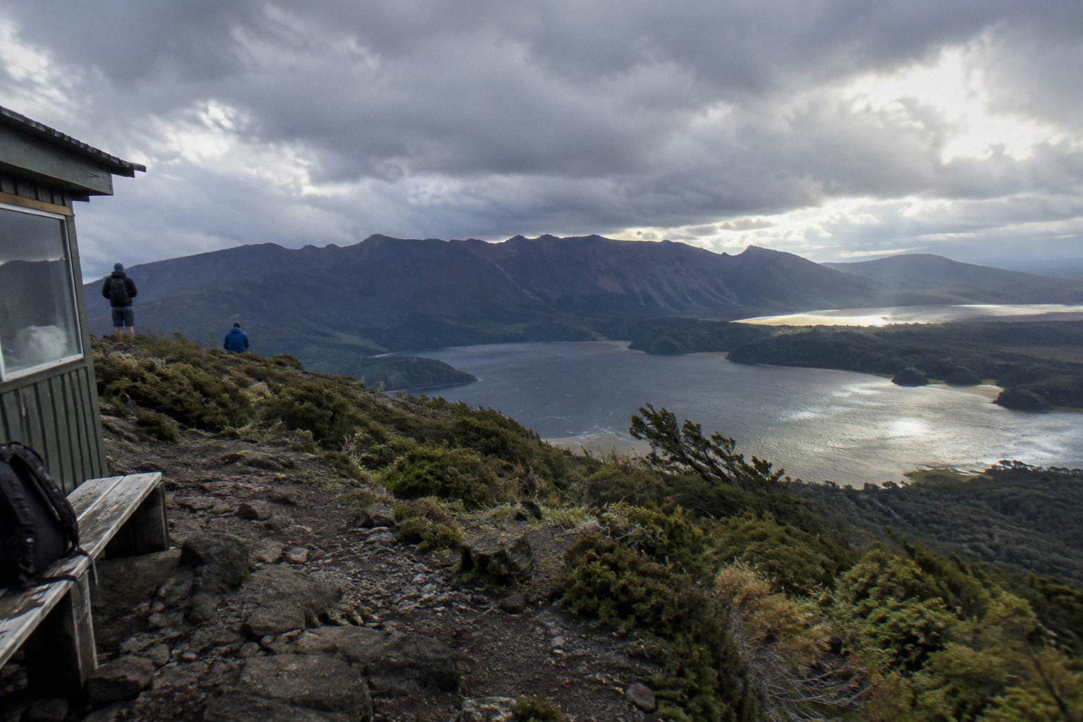
When a guide stands at the top of the scree and turns to face the group, the story usually begins with the ground itself. Tarawera is one of the dome volcanoes of the Okataina Volcanic Centre, east of Rotorua, and GNS calls the 10 June 1886 eruption New Zealand's largest during the last 500 years. The summit under a walker's boots, Ruawahia Dome at 1,111 m, is the highest of three domes, and the eruption tore through all of them in a single night.
The human cost sits at the centre of that telling. The people who died were not climbers or day-trippers on the mountain; they were residents of villages near its base, mostly Maori communities at Te Wairoa and around the shores of the lakes. The eruption began in darkness, and the sound was heard as far as Blenheim while ash fell as far as Christchurch. Guides tend to deliver those facts quietly, and a good one lets the landscape do the rest of the work.
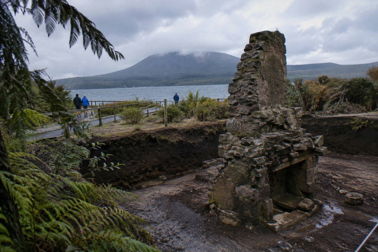
There is a reason the story lands differently here than in a museum. The villages that were struck sat in the shadow of the domes you can see from the summit. The Buried Village of Te Wairoa, on Tarawera Road, is one of those places, and its excavated remains can still be visited on a separate outing. Walking the crater rim, with the lake country spread below, gives the numbers a geography that no plaque can.
For anyone weighing how to experience that landscape first hand, three formats stand out from the trips covered here. The guided walk reaches the crater on foot, a helicopter landing puts a small group on the summit briefly, and a full-day combo pairs the mountain with whitewater rafting. Each tells the 1886 story in its own register, and each is described in plain terms below.
What GNS Science States About The Deaths
GNS Science, in its volcano fact sheet for Tarawera, states that more than 100 people were killed in villages near the mountain. It gives no exact total and no breakdown by village or by group. The same fact sheet calls the eruption New Zealand's largest during the last 500 years, and records that the sound was heard as far as Blenheim and ash fell as far as Christchurch. Those are the claims a careful reader can rely on.
The reason no single number appears in modern official material is that the sources disagree. Some accounts compiled in the decades after 1886 arrive at one total, others at another, and later historians have shifted between them as evidence was re-examined. Rather than pick a winner, the geoscience institute states the floor of the loss, more than 100, and leaves it there. A guide who has been telling the story for years will usually do exactly the same thing.
| What the record states | Where it comes from |
|---|---|
| More than 100 people were killed in villages near the mountain | GNS Science volcano fact sheet |
| The eruption occurred on the night of 10 June 1886 | GNS Science; Wikipedia agrees on the date |
| It was New Zealand's largest eruption during the last 500 years | GNS Science |
| The sound was heard as far as Blenheim | GNS Science |
| Ash fell as far as Christchurch | GNS Science |
| Exact totals differ between sources | Stated once here; no figure beyond "more than 100" is used |
Notice what is absent from that table: a precise death toll, a start time, a duration, a rift length and a crater size. GNS and other accounts diverge on the rift length and the eruption's start time, so neither figure appears here; the death toll stays at the careful estimate of more than 100 people. Keeping to what the primary record states is not evasion; it is the difference between history and folklore.
The same discipline applies to the terraces. GNS says the eruption destroyed the Pink and White Terraces, and Wikipedia notes that a small portion of the Pink Terraces was reportedly rediscovered under Lake Rotomahana in 2011. Both statements are attributed, neither is inflated, and no page should promise that any trip visits their remains.
Guides earn their keep in exactly this way. The Kaitiaki Half-Day 4WD And Crater Walk, a 4 hours 30 minute trip rated 4.9 across 359 reviews, puts a local guide beside you on the summit track, and the operator's own FAQ spells out the route, the base camp stop and the fitness call for the scree in plain terms. That is the format where the story gets the most room to breathe.
Where The Eruption Struck: The Villages Near The Mountain
The deaths occurred in villages near the mountain, not on its summit. Te Wairoa was the largest of them, a settlement a short distance from the lake shore, and it was buried by ash and mud in the darkness. Smaller communities around the lake country were struck in the same hours. GNS groups all of the loss together in its single statement: more than 100 people killed in villages near the mountain.
Te Wairoa today is the Buried Village, an excavated site at 1180 Tarawera Road where visitors can walk through what the night left behind. It opens 10am to 4pm Wednesday to Sunday, with last entry at 3.45pm, and it is closed Monday, Tuesday and Christmas Day. Pairing a morning on the crater with an afternoon among the excavated remains is a common shape for a day, and the two halves of it explain each other: the force above, the consequences below.
The lake itself carries the story further. Lake Rotomahana, which held the famous terraces, was reshaped by the eruption, and the Waimangu Volcanic Valley to the south describes its geothermal system as formed as the result of the eruption on 10 June 1886. A visitor who walks the crater, then drives the valley road, sees the same night told in three different landscapes, and each one answers a question the previous one raises.
It is worth being precise about names, because loose telling blurs them. The Tarawera Trail, a 15 km advanced tramping track documented by the Department of Conservation, runs from the Te Wairoa car park along the lake edge to the Hot Water Beach campsite; it is a lake track, not a route up the mountain, and the department notes that localised patches of sand at Hot Water Beach are very hot. None of that trail is the crater walk, and the crater walk is not the trail.
The Night Of 10 June 1886
The eruption took place on the night of 10 June 1886, and that night is the only time marker a careful account can stand behind, because GNS Science gives no start time in the material used here and other sources disagree on when the main phase began. One of New Zealand's dome volcanoes split the darkness that night, and by morning the landscape and the communities around it had changed for good.
What the record does state, plainly, is scale. The eruption was New Zealand's largest during the last 500 years, a phrase from the GNS fact sheet that appears on the walk, in the guidebooks and in nearly every serious retelling. The sound reached Blenheim, at the top of the South Island, and fine ash drifted as far as Christchurch. Those two details do more to convey the size of the event than any pile of adjectives, which is why guides reach for them first.
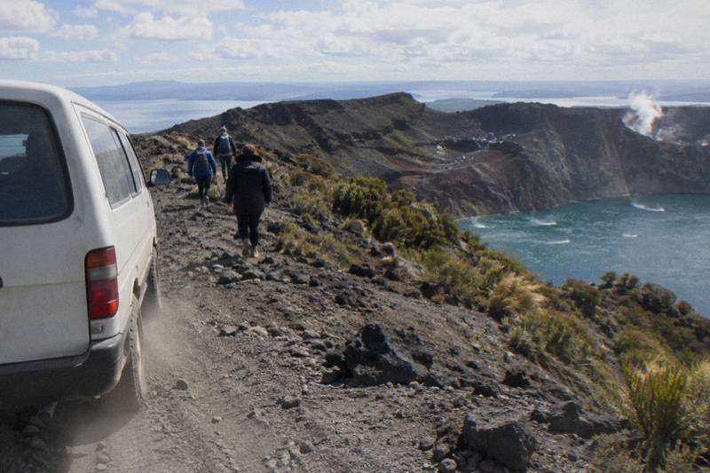
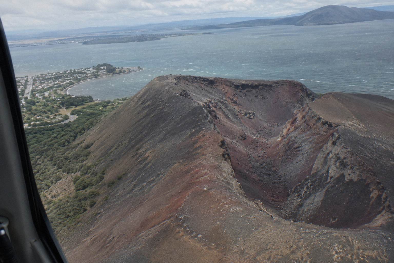
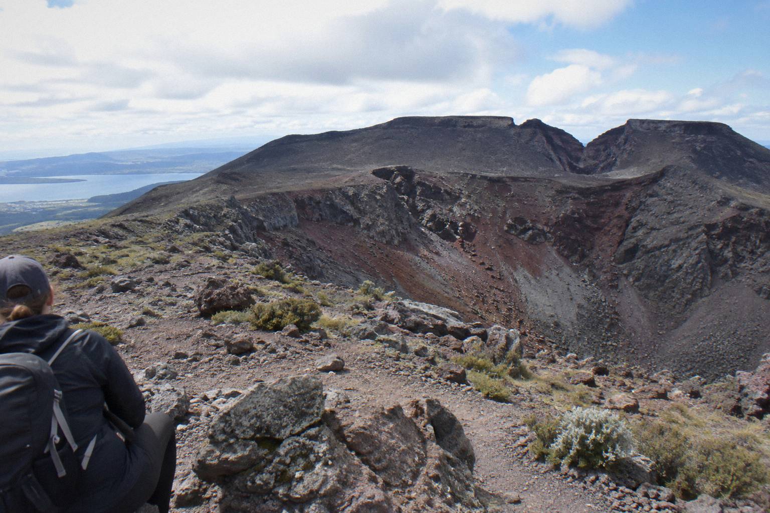
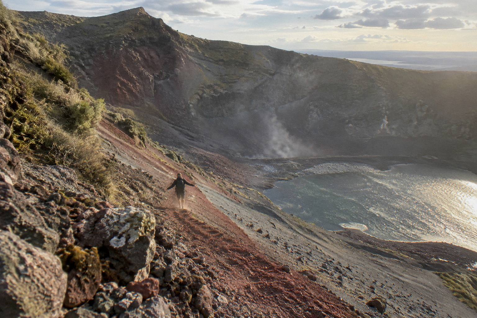
The domes themselves tell the physical story. Ruawahia, Tarawera and Wahanga form the summit line, with Ruawahia the highest at 1,111 m, and the walking track follows the crater edge between them. Standing there, with the red scoria underfoot and the rift visible as a long tear in the ridgeline, the idea that a single night reshaped all of it stops being abstract. That is the moment most guided trips are built around.
What the night did not do is equally worth stating. GeoNet, the official monitoring service, publishes the current volcanic alert level for Okataina, the caldera that contains Tarawera, so check it before you travel, and GNS describes a dome volcano inside an active caldera rather than a smoking hazard. Guides on the mountain speak about the past with gravity and about the present with calm, and both halves of that sentence belong in any account a visitor reads before booking.
The Pink And White Terraces And What Remains
GNS Science states that the 1886 eruption destroyed the Pink and White Terraces, the famed silica formations on the shores of Lake Rotomahana. Wikipedia records that a small portion of the Pink Terraces was reportedly rediscovered under the lake in 2011. The terraces themselves are gone from view. No tour visits their site, and no reliable dimension for them is confirmed, so treat any Tarawera guided trip as a crater and summit experience rather than a chance to see them.
The terraces belonged to the same night as the deaths, and guides usually tell the two together. The formations drew visitors from around the world before 1886; the eruption buried and flooded them, and the communities that hosted those visitors were among the villages where more than 100 lives were lost. The loss of a famous landmark and the loss of more than 100 people are part of one event, and separating them, making the terraces the headline, gets the emphasis wrong.
The 2011 rediscovery claim deserves its careful phrasing. What is attributed is a small portion, reportedly found beneath Lake Rotomahana, and the word "reportedly" carries real weight: it is an attributed research finding, not a visitor experience. No boat trip, flight or walk delivers anyone to it. A flyover of the volcanic landscape with pilot commentary, such as the Tarawera Scenic Floatplane Flyover, from NZ$395 per person and rated 4.8 across 48 reviews, shows the lakes and the mountain from above, but it is a flyover with no landing, as its own description states.
For visitors who want the geothermal afterglow of that night in a walkable form, the Waimangu Volcanic Valley, at 587 Waimangu Road, is the adjacent destination. It describes its system as formed by the 1886 eruption, and its valley walk makes the connection tangible. All amounts mentioned anywhere in these pages are New Zealand dollars, stated once here for clarity.
How The Story Is Told On The Mountain Today
Guides on Tarawera tell the 1886 story on site, at the crater rim, in the time the format allows. The half-day walk gives the story the most room, with about 90 minutes of guided crater walking per the booking page wording. A helicopter landing compresses it into a short summit walk, and a flyover frames it from the air with commentary alone. The facts stay the same; the depth of telling changes with the format.
The walking format is the one built for storytelling. The Kaitiaki trip meets at the Main Carpark on Hemo Road in Whakarewarewa, drives about 30 minutes to the base of the 4WD track, then covers roughly 8.2 km of off-road climbing before the walk begins. Benches along the track give a guide natural pauses, and the operator's FAQ describes a base camp stop with a composting toilet and walking sticks. That rhythm, drive, stop, climb, is where a guide fits the night of 10 June 1886 between the view and the scree.
The operator is also explicit about what is not provided. No snacks are given, so water and food come with you, and the summit track calls for moderate fitness, with the scree described in the FAQ as a 45 degree slope approximately 400 m deep. Telling the hard parts straight is part of the same respectful register as telling the history straight: no drama, no polish, just what a visitor needs to decide.
Readers planning a wider Rotorua stay may also want the step-by-step crater walk account or the comparison in choosing a walk, 4WD or helicopter format. The Mt Tarawera Volcano Hike collection covers both, and the story of 1886 threads through nearly every page of it. To check dates for a walking trip, see the half-day crater walk trip or Check availability.
The 4 hours 30 minute trip, rated 4.9 across 359 reviews, states free cancellation up to 24 hours on the booking page, and the booking pages offer pickup from central Rotorua accommodation, with arrangements confirmed when you book.
Who Looks After The Mountain And Why Access Is Guided
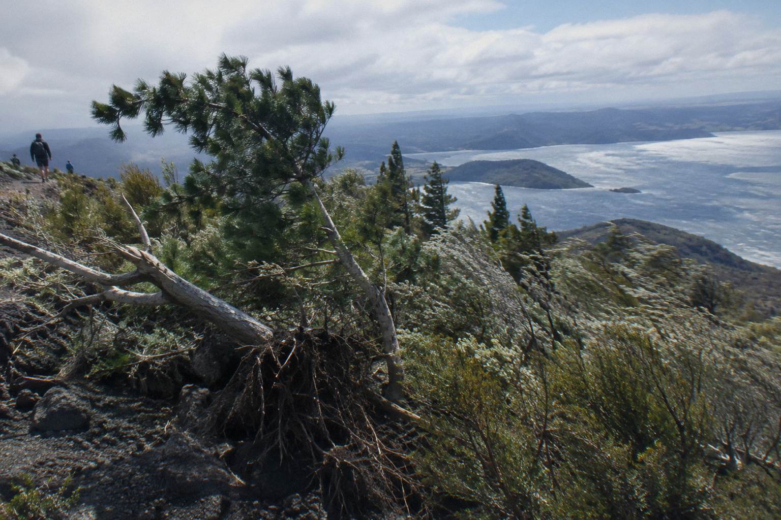
Mt Tarawera sits on private land governed by the Ruawahia 2B Trust, which reinvests most tourism concession revenue in conservation, with wilding pine removal first. Ngati Rangitihi hold kaitiakitanga, guardianship, of the maunga, and Kaitiaki Adventures and Volcanic Air describe themselves as concessionaires working alongside the iwi. Guided access is how visitation funds the care of the place, which is itself part of the story told on the crater rim.
That structure explains something visitors often ask about on the walk: why a guide at all. The answer is not just safety, though the scree sections, two stretches of about 50 m needing four points of contact per the operator's FAQ, make a guide sensible. It is that the mountain is a governed place, whose tourism revenue flows back into removing wilding pines and into work and training for Ngati Rangitihi rangatahi, young people, as the operator's conservation page sets out.
For readers who want the fuller picture, the guide to who owns the mountain and why access is guided covers it in depth. A visitor who understands the guardianship understands why the story is told quietly.
Formats Side By Side: Where The Story Fits
The story fits best on foot: the 4 hours 30 minute guided walk gives the 1886 story the most time on the ground. The 40-minute helicopter flight, from NZ$675 per person and rated 4.9 across 43 reviews, pairs it with a short summit walk at the pilot's sole discretion, while the 9-hour Kaituna combo compresses it into a 90-minute crater walk alongside rafting; none is better, just built for different plans.
| Trip | Format | Duration | What the record shows |
|---|---|---|---|
| Kaitiaki Half-Day 4WD And Crater Walk | Guided 4WD and crater walk | 4 hours 30 minutes | 4.9 across 359 reviews; the booking page shows the amount for your date |
| Kaituna Rafting And Tarawera Crater Walk Combo | Rafting plus crater walk | 9 hours | About 1.5 hours rafting, about 90 minutes of guided crater walk; rating not given |
| Volcanic Air 40-Minute Summit Landing Flight | Helicopter landing | 40 minutes | From NZ$675 per person; 4.9 across 43 reviews; landing at the pilot's sole discretion |
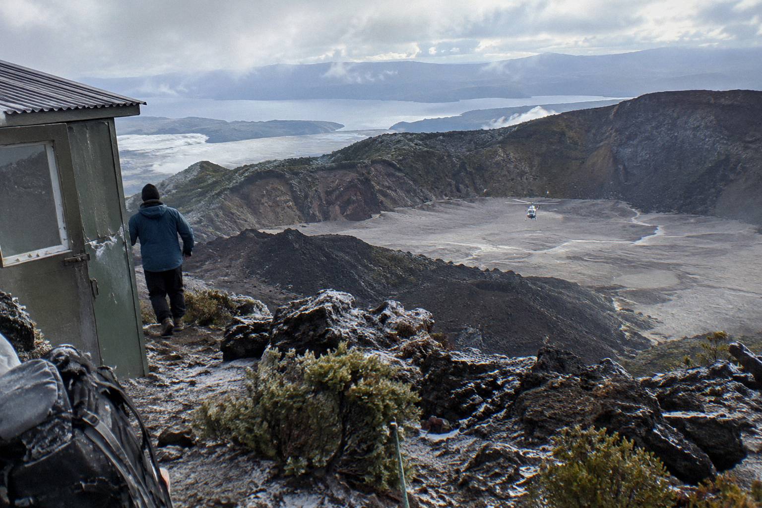
The helicopter format deserves one careful note, and Volcanic Air states it in its own words: excursion landings are undertaken at the passenger's risk and are at the pilot's sole discretion, depending on weather, volcanic activity and passenger loadings. The flight passes over lakes Okareka, Okataina and Tarawera before any landing, so even a day when the summit walk is shortened still delivers the geography of 1886 from above.
The rafting combo suits a visitor with one full day and two appetites. The booking page details river gear and safety equipment, 4x4 transport up the mountain, a 90-minute guided crater walk and complimentary transport from central Rotorua, with 22 pickup options and returns between the two activities. Its minimum age is 13, against 7 for the half-day walk, which matters for families deciding between them.
Common Mistakes About The Eruption Story
Four errors recur in retellings of 1886. An exact death toll is stated when sources differ; an eruption time is given when the accounts conflict; the terraces are called lost forever when a portion was reportedly rediscovered in 2011; and the mountain is called an active volcano in a way that misstates what the monitoring record shows. Avoiding all four is simply a matter of keeping to what the primary sources actually say.
The death toll is the most common slip. A number picked from one old account gets repeated until it looks official, and it never was. GNS gives the floor, more than 100, and states no more; the differences between historical totals were noted once above and need no second airing. The same restraint applies to the rift length and start time, where GNS, Volcanic Air and other accounts diverge; no figures are stated here, only the careful toll of more than 100 people.
The terraces error runs the other way: from drama into denial. The eruption destroyed the formations, that is the GNS position, and the reportedly rediscovered small portion of the Pink Terraces does not revive them as a destination. No dimension, no wonder-ranking and no visiting promise belongs in an account of them, and none appears here.
The "active volcano" label is the subtle one. GeoNet publishes the Okataina Volcanic Centre's current volcanic alert level, so check it before you travel. GNS frames Tarawera as a dome volcano within an active caldera. A visitor who arrives expecting steaming vents finds instead a quiet, red-rocked summit with a lake panorama, and a guide whose storytelling makes the quiet itself feel earned. Monitoring status changes any day, and current status can be checked at GeoNet's volcano pages.
Questions Worth Asking Before You Book
Practical questions shape the visit as much as the history does. Families ask about ages, with 7 the minimum for the half-day walk and 13 for the rafting combo. Weight rules apply on the helicopter flights, with 135 kg per seat stated for the 40-minute trip. Cancellation terms matter in a mountain climate, and all six trips state free cancellation up to 24 hours on their booking pages. Each answer below comes from the operators' own published details.
For departure times on a specific date, pickup arrangements beyond what is described above, and any age question on the flights, ask when you book. The operators answer these questions daily, and asking is part of booking well.
The half-day walk suits most first visitors: it needs moderate fitness, sturdy shoes, water and snacks, and it gives a guide about 90 minutes of crater walking, per the booking page wording, in which to tell the whole story. Families with children from 7 up can take it; families with teenagers wanting a bigger day can look at the combo. Visitors short on time or keen on the aerial view can take the helicopter route and still stand, briefly, on the summit.
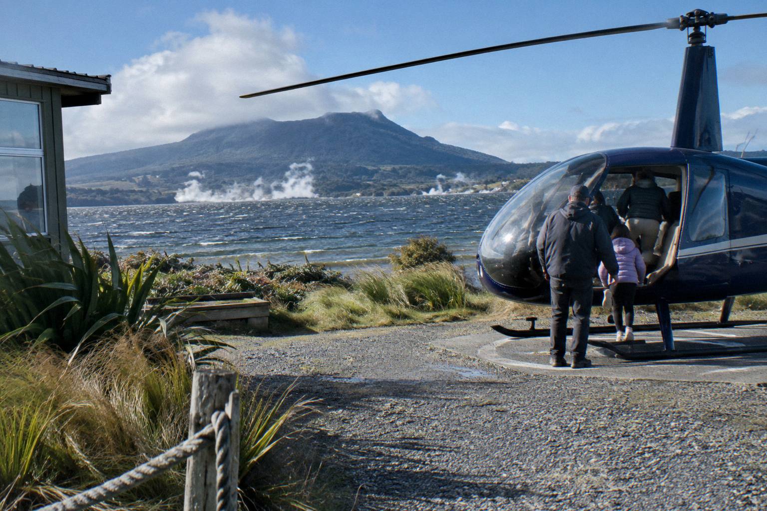
Whichever format fits, the 1886 story earns the trip. Standing on Ruawahia Dome at 1,111 m, looking down the long tear of the rift toward the lakes that hold the terraces' remains, the phrase "more than 100 people" stops being a statistic and becomes a place. That is what the crater walk does that no book quite manages.
The 40-minute flight, from NZ$675 per person and rated 4.9 across 43 reviews, runs to the lakefront helipad at 1 Lakefront Drive and needs a minimum of 2 adult fares to operate.
Common Questions About The 1886 Eruption
How Many People Died In The 1886 Eruption Told On The Crater Walk?
More than 100 people were killed in villages near the mountain on the night of 10 June 1886, per GNS Science. Sources differ on any exact total, so no more precise figure is used by careful guides or on these pages.
When Did The Eruption Happen?
The eruption took place on the night of 10 June 1886. Accounts differ on the exact start time and duration, so the date alone is the reliable marker.
Were The Pink And White Terraces Destroyed?
GNS Science states the eruption destroyed them. Wikipedia records that a small portion of the Pink Terraces was reportedly rediscovered under Lake Rotomahana in 2011. No trip visits their site.
Is Mount Tarawera An Active Volcano?
GNS describes Tarawera as a dome volcano inside an active caldera, and GeoNet publishes the Okataina Volcanic Centre's current volcanic alert level; check it before your trip. Status can change and can be checked on GeoNet's volcano pages.
Can You Visit The Villages That Were Struck?
Yes, the Buried Village of Te Wairoa at 1180 Tarawera Road is open 10am to 4pm Wednesday to Sunday, last entry 3.45pm, closed Monday, Tuesday and Christmas Day. It pairs well with a morning crater walk.
Do The Guided Trips Tell The Eruption Story?
Yes. The guided walks include commentary on the 1886 eruption during the crater walk, and the helicopter and floatplane formats cover it with pilot commentary from the air.