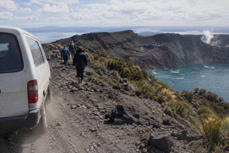
Mt Tarawera Crater Walk: The Route From Start To Summit
The Mt Tarawera crater walk follows a set sequence: a carpark meeting, a drive, an 8.2 km 4WD track, a base camp stop, benches, a summit trail and a scree slope. Here is each stage in the operator's own words.
Short answer
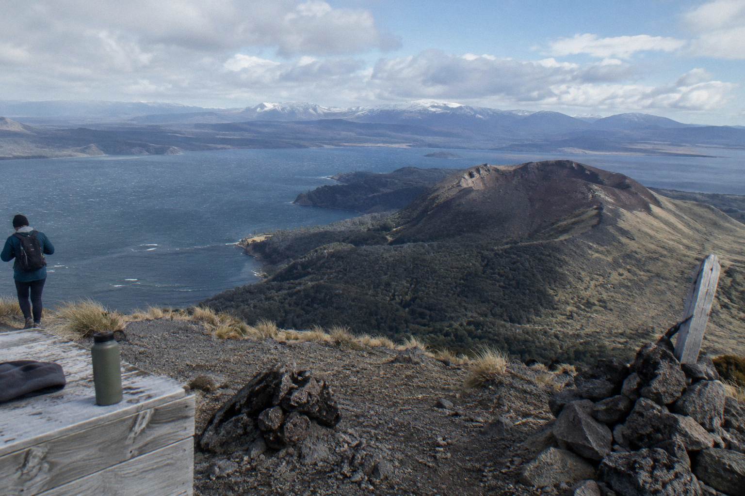
The half-day crater walk runs 4 hours 30 minutes in all, meeting at the Main Carpark on Hemo Road in Rotorua. After roughly a 30-minute drive and 8.2 km of 4WD track, a 90-minute guided crater walk covers benches, a summit trail at 1,111 m and a scree slope, with an optional run down.
Mount Tarawera stands 1,111 m above the Rotorua lakes country, and walking its crater is a guided, staged affair rather than a casual trailhead stroll. The mountain is governed by Ruawahia 2B Trust, which reinvests most tourism concession revenue in conservation, with wilding pine removal first, and Ngati Rangitihi hold kaitiakitanga over the maunga. The trip covered in detail here is the Kaitiaki Half-Day 4WD And Crater Walk, rated 4.9 across 359 reviews and running 4 hours 30 minutes in all. Its stages come from the operator's own FAQ and booking page, quoted as the operator's wording throughout, and no stage has been padded with guessed distances or timings.
The Mt Tarawera Crater Walk From Carpark To Crater
From the Main Carpark, you drive about 30 minutes, ride roughly 8.2 km of off-road 4WD track, stop at base camp for walking sticks and a composting toilet, then walk past the benches to the second one, where the guide shows the summit trail. After crossing the scree with two short four-point sections, you can run down into the crater, and the booking page allows 4 hours 30 minutes including the 90-minute guided crater walk.
Each of those stages gets its own section below, in order, using the operator's FAQ sequence and nothing invented around it. No walk distance, ascent figure or crater dimension is given here. What the FAQ describes is a shape: vehicle stages first, a gear stop, then a walk that gets steeper as it goes, finishing with loose ground and a choice at the top.
That shape matters for anyone deciding whether the trip fits them. Roughly the first half of the 4 hours 30 minutes is travel: a carpark meet, a sealed-road drive and a long, bumpy off-road stretch in a 4x4. The walking itself is concentrated into the back half, with the 90-minute guided crater walk the operator's own figure. If you are comparing against a helicopter format, the helicopter landing and summit walk option swaps the drive and the 4WD track for a flight, which is a different sequence entirely.
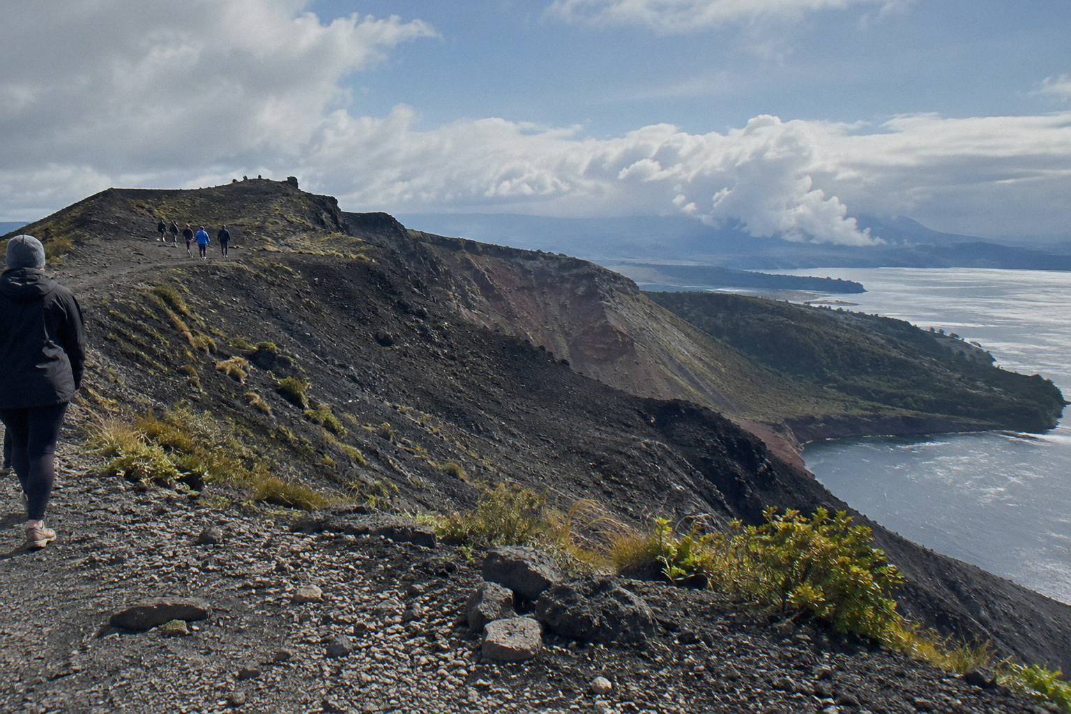
Context helps too. The mountain is one of the dome volcanoes of the Okataina Volcanic Centre, and the 10 June 1886 eruption was New Zealand's largest during the last 500 years, killing more than 100 people in villages near the mountain. The summit you walk toward, Ruawahia Dome, is the highest of the mountain's three domes. The walk is therefore a visit to a place with a recorded history, not just a viewpoint.
The Carpark, The Drive And The 4WD Track
You meet at the Main Carpark on Hemo Road, Whakarewarewa, in Rotorua. From there the operator describes about 30 minutes of driving to the base of the Mt Tarawera 4WD track, followed by roughly 8.2 km of bumpy off-road travel in a 4WD vehicle. The road ends where the walk, the hikoi, begins.
The Hemo Road meeting point is where trips start, and the trip ends back at that same meeting point. Free pickup from central Rotorua accommodation can be arranged, which is worth doing if you would rather not drive to the carpark at all; confirm the pickup timing for your date when you book. Departure times and group sizes show during booking.
The 8.2 km figure is the operator's own wording for the off-road stretch, and it is the only distance the operator gives for the whole journey. Treat it as a description of the drive, not of any walking. The FAQ calls that stretch bumpy, and it also carries a motion-sickness note: guests who suffer motion sickness are asked to tell the guide. Anyone prone to carsickness on gravel roads should take that warning seriously, because more than eight kilometres of it stands between the sealed road and the walking.
Why the 4x4 at all? The upper mountain has no public road, and guided access runs under concession. Both operators running summit trips here, Kaitiaki Adventures and Volcanic Air, describe themselves as concessionaires working alongside Ngati Rangitihi, per Kaitiaki's conservation values page. So the vehicle stage is not a gimmick; it is the only way the walk reaches the foot of the summit track.
If the drive sounds like the wrong half-day for you, a flight replaces it entirely. The three trips below cover the same summit country by foot, by combo or by helicopter.
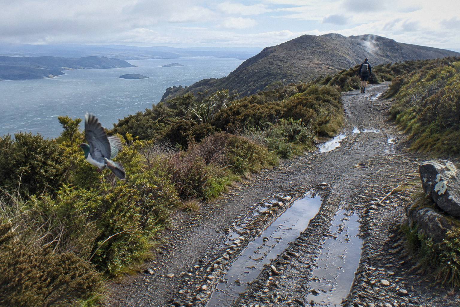
For a fuller comparison of the formats, the walk, 4WD or helicopter decision lays out what each one trades away.
Base Camp, Walking Sticks And Where The Hikoi Starts
Base camp is a stop partway up the mountain where the operator hands out walking sticks and where a composting toilet is available. The FAQ places it at the point where the 4WD stage gives way to the walk: the road ends, and the hikoi, the walking stage of the trip, begins from there.
Two practical things happen at base camp. First, walking sticks are given out, free, to anyone who wants one. Given what the FAQ says later about the scree and about volcanic scoria that can be slippery, taking a stick is a sensible default rather than a sign of caution. Second, the composting toilet is the toilet stop the operator names on the whole journey, so the standard advice applies: use it here, because the FAQ names no other.
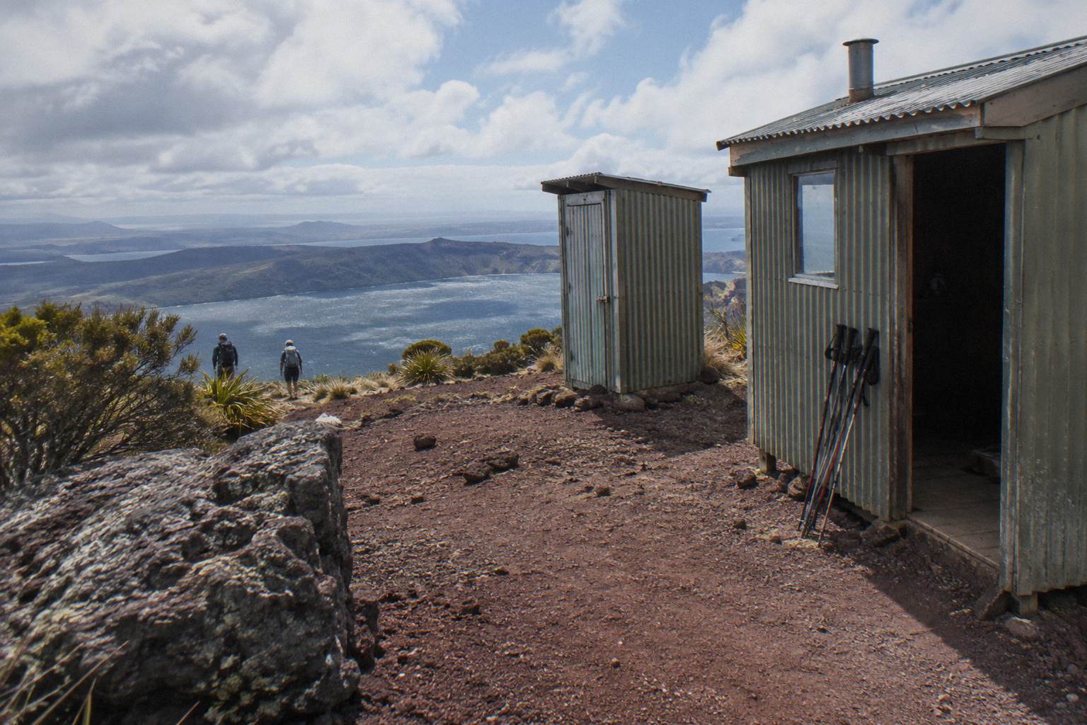
Base camp is also the psychological halfway marker. Everything before it has been sitting down; everything after it is on foot. The operator's FAQ frames the transition plainly: the road ends where the walk starts. There is no vehicle support above this point, which is why the packing advice in a later section matters more than it would on a drive-to viewpoint walk.
The question of toilets on the trip, and of what else is or is not provided, comes up often enough that it has its own write-up: see whether drinks and snacks are included for the short answer. Spoiler-free version: Kaitiaki says it provides no snacks, so whatever you want to eat, you carry it from the carpark.
Benches, The Second Bench And The Summit Trail
The walk up passes benches, and at the second bench the guide shows the summit trail. The FAQ uses that second bench as the landmark where the route leaves the easier ground and begins the summit track proper, the section for which the operator says a medium to moderate fitness level is needed.
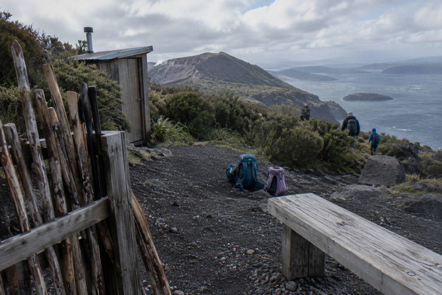
The benches matter because they structure the climb. The FAQ describes them as points along the way, and guests who want a lighter day may take lighter walking options instead of the summit, per the operator's own wording. That is worth underlining: the summit track is optional within the trip. Someone in your group who would rather not attempt the steeper section can, in the operator's words, take a lighter walking option, and the guide structure is what makes that possible.
The second bench is the decision point. From there the guide points out the summit trail, and the character of the walk changes from a steady volcanic stroll to a track the operator rates as needing moderate fitness. If you have been wondering whether your fitness is enough, the operator's own benchmark is "medium/moderate", and the difficulty and fitness breakdown covers who that typically includes and excludes, including the booking page's list of conditions it marks as not suitable.
Would you rather see the summit from above before committing a half-day to it?
The booking page for the half-day walk shows the amount for your date, includes a local guide, 4x4 transport and hotel pickup and drop-off from central Rotorua, and carries free cancellation up to 24 hours.
The Scree And The Two Four-Point Sections
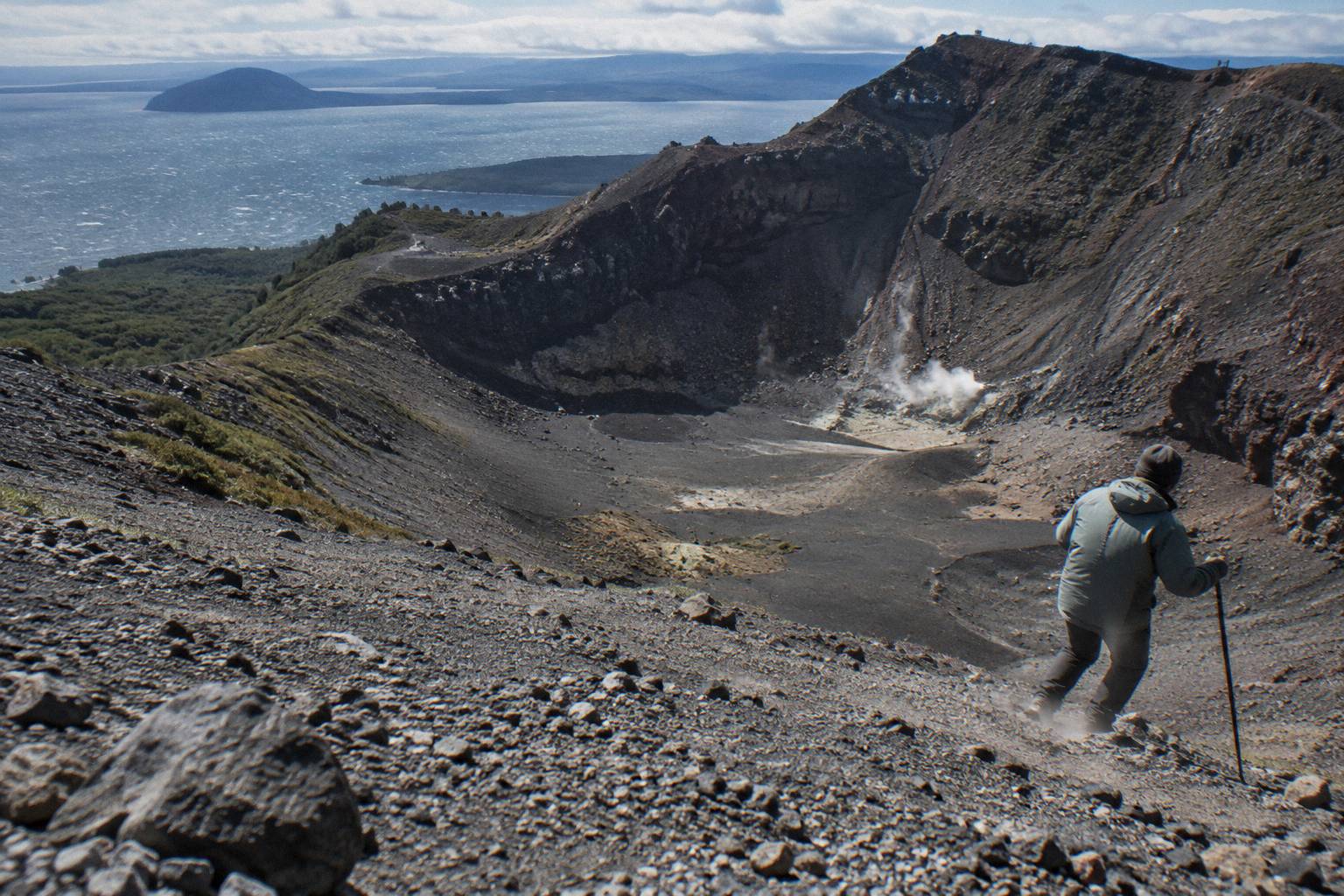
The scree is described in Kaitiaki's own FAQ words as "a 45 degree slope approximately 400m deep". The FAQ also warns that the ground is volcanic scoria that can be slippery, and that two sections of about 50 m each need four points of contact, meaning hands as well as feet. Those two sections are the most physically demanding part of the route.
The quoted description belongs to the operator and is reproduced here only as its wording, not as a survey measurement of the mountain. Taken at face value, though, it tells you the scree stage is steep, loose and long enough to respect. The walking sticks from base camp earn their keep here, and sturdy footwear does the same; the FAQ says sturdy walking shoes, with sturdy trainers acceptable, which rules out anything with a smooth sole.
The four-points-of-contact sections are short, about 50 m each by the operator's figure, but they change the nature of the walk from hiking to light scrambling. Nothing in the operator's material calls them dangerous, and nothing here should either; they simply require hands on ground, which is why the booking page lists low fitness, back problems, heart problems and serious medical conditions as not suitable. Anyone unsure how their body handles short steep scrambles should raise it with the operator when booking.
| Stage | What the operator says | Who it challenges |
|---|---|---|
| Carpark to track base | About 30 minutes' drive, then roughly 8.2 km of bumpy 4WD track | Motion-sickness-prone passengers |
| Base camp stop | Walking sticks given out, composting toilet | Everyone, briefly |
| Walk to the 2nd bench | Benches along the way; lighter walking options exist | Most walkers manage |
| Summit trail from the 2nd bench | Medium to moderate fitness needed | Guests with low fitness, per the booking page |
| Scree and the two 50 m sections | "45 degree slope approximately 400m deep", scoria can be slippery, four points of contact twice | Anyone with back or heart problems, per the booking page |
| Optional run down | Half-day page mentions an optional run down into the crater | A choice, not a requirement |
The sequence above is the whole route in one view, and every cell traces back to the operator's FAQ, booking page or half-day description.
The Optional Run Down Into The Crater
At the top, the half-day page mentions an optional run down into the crater. It is a choice, not a requirement of the trip: the same operator material that offers the run also offers lighter walking options instead of the summit, so a guest can complete the day without descending the loose ground at all.
The run down is the part of the day people remember and the part videos are made of, but the operator's framing keeps it optional. Descending loose scree quickly is a skill the body learns in the first thirty seconds, and the climbing sticks from base camp are usually still in hand. The FAQ's slippery-scoria warning applies on the way down more than on the way up, which is the single best argument for keeping your shoes grippy and your hands free.
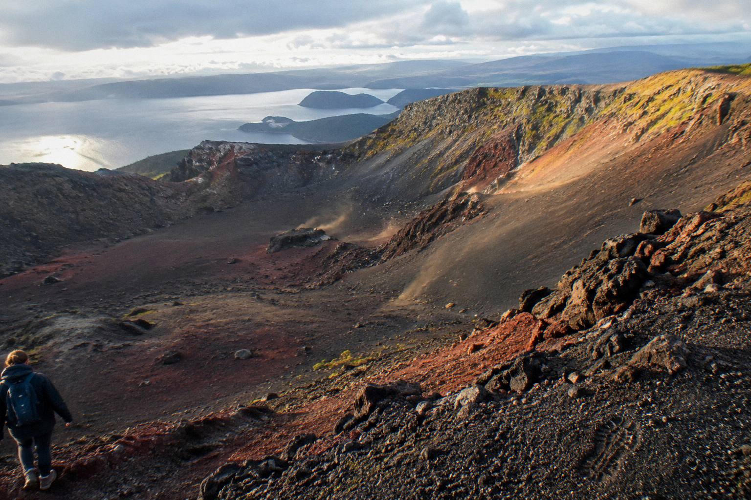
Whether you run down or walk down, you come back the same way to the vehicle stages, and the trip ends back at the Hemo Road meeting point. The booking page's 90-minute guided crater walk figure covers the walking portion, inside the 4 hours 30 minutes total. The step count and timing question digs into how those minutes are usually spread.
If your knees would rather not meet that scree at all, a helicopter puts you on the summit without it. The 1-hour Volcanic Air flight below lands about 20 minutes on the mountain, with the landing at the pilot's sole discretion.
Fitness, Ages And Who The Route Suits
The operator says medium to moderate fitness is needed for the summit track, with lighter walking options available instead. The booking page sets a minimum age of 7 and lists low fitness, back problems, heart problems and serious medical conditions as not suitable, and the trip is not wheelchair accessible. Moderate fitness is the stated benchmark for the day.
Those are the operator's own gates, and they are worth reading as a set rather than a single threshold. A reasonably active adult clears them comfortably. The people the booking page is steering away are those for whom two 50 m hands-on sections and a steep scree slope would be a medical question rather than a workout. Families should note the age floor: 7 as the operator states it, and the family-focused write-up on guided hikes with kids and age limits covers how that plays out in practice.
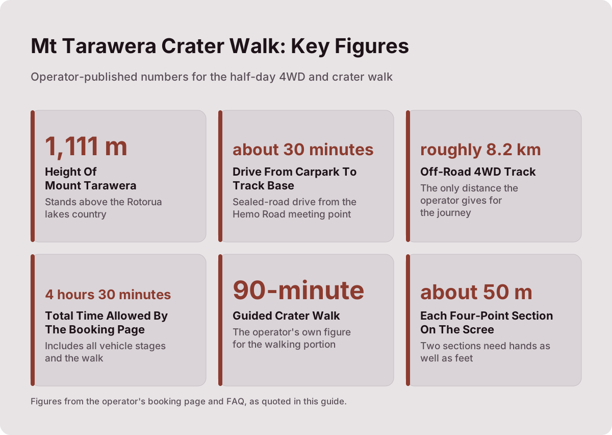
The 1,111 m summit figure comes from GNS Science, and it is the highest of the three domes. Altitude itself is not the challenge at that height; the ground underfoot and the steepness of the final sections are.
What To Wear And What To Bring
The operator's list: sturdy walking shoes, with sturdy trainers fine; comfortable clothing for the weather; a bottle of water; and snacks, because Kaitiaki says it provides none. Walking sticks are handed out at base camp, and guests prone to motion sickness are asked to tell the guide before the drive.
The list is short because the trip is short and the operator supplies the rest: guide, 4x4 transport and, per the booking pages, pickup and drop-off from central Rotorua accommodation. Water deserves a moment of thought, since the only toilet and the only rest structure sit at base camp, and the walking stage runs 90 minutes by the booking page's figure. There is no water top-up on the mountain, so carry what you will drink.
| Item | Operator's wording | Notes |
|---|---|---|
| Footwear | Sturdy walking shoes; sturdy trainers are fine | Smooth-soled shoes are a poor match for scoria |
| Clothing | Comfortable clothing for the weather | The summit is colder and windier than Rotorua town |
| Water | A bottle of water | No refill point is named above base camp |
| Snacks | Bring snacks; Kaitiaki provides none | The FAQ is explicit |
| Walking sticks | Given out at base camp | Take one by default for the scree |
| Motion sickness | Tell the guide | 8.2 km of bumpy off-road each way |
One climate note, stated carefully: Rotorua town's published climate normals describe the town at about 280 m, not the summit. The summit at 1,111 m is colder and windier than the town below, on any day of the year. No summit temperature is published, so the workable rule is simple: dress one notch warmer than the carpark feels. The full packing treatment, including what to wear month by month, sits in the what to wear and bring guide.
Weather, Cancellations And Landing Discretion
Weather shapes the whole day. Free cancellation up to 24 hours applies on the booking page for every trip covered here, and for flights Volcanic Air states that tour duration, flight times and landings may vary with weather, volcanic activity and passenger loadings, with landings at the pilot's sole discretion. Ask about the weather cancellation policy for the walk when you book.
For walkers, weather mostly changes comfort and views rather than feasibility; the operator holds the trip or not, and unpublished policies mean the answer lives with them. For flyers, the discretion clause is the fine print that matters most: a landing is never guaranteed, and the same clause appears across the Volcanic Air products. The dedicated weather and landing page works through what that means for planning, and the monthly normals behind the timing question sit in which months suit a crater walk.
Rotorua's published town normals give a rough calendar: July is the wettest month at 137.4 mm of rain on average and the coolest by mean daily maximum at 12.0 °C, while February is the warmest at 23.1 °C and November the driest at 86.8 mm. Those are town figures at about 280 m and say nothing definitive about summit conditions, but they do say when the drive and the 4WD track are likeliest to be pleasant.
For a lower-commitment way to see the mountain in marginal weather, the floatplane flyover, from NZ$395 per person and rated 4.8 across 48 reviews, overflies Tarawera without landing; amounts here are New Zealand dollars.
Walking, Flying Over Or Landing: How The Formats Differ
The three formats are: a guided walk on foot with a 4x4 approach; a helicopter flight that lands on the summit for a guided walk of about 15 to 20 minutes depending on the page quoted; and a floatplane flyover that never lands. The walk gives the longest time on the mountain, the flight the fastest summit, the flyover the lowest price from NZ$395 per person.
All amounts below are New Zealand dollars, booking-page from-prices per person. Where a trip shows no amount here, check its booking page for the figure for your date, and ask the operator for anything further.
| Trip | Format | Duration | From price | Rating |
|---|---|---|---|---|
| Kaitiaki Half-Day 4WD And Crater Walk | 4x4 approach plus 90-minute guided crater walk | 4 h 30 m | On the booking page | 4.9 across 359 reviews |
| Kaituna Rafting And Tarawera Crater Walk Combo | Rafting plus the crater walk | 9 h | On the booking page | Not published |
| Volcanic Air 40-Minute Summit Landing Flight | Helicopter, summit landing and guided walk | 40 min | NZ$675 | 4.9 across 43 reviews |
| Volcanic Air 1-Hour Mountain Landing Flight | Helicopter, about 20 minutes on the mountain | 1 h | On the booking page | Not published |
| Tarawera And Orakei Korako Dual Landing Flight | Two landings, Tarawera and Orakei Korako | 3 h | NZ$1,490 | Not published |
| Tarawera Scenic Floatplane Flyover | Flyover, no landing | 30 min | NZ$395 | 4.8 across 48 reviews |
No format is better than another; they answer different briefs. The walk suits people who want hours on the volcanic ground. The 40-minute flight, from NZ$675 per person, trades those hours for a flight over lakes Okareka, Okataina and Tarawera and a short guided summit walk, about 15 minutes by the operator's page or about 20 minutes by the booking page. The combo bolts roughly 1.5 hours of Kaituna River rafting onto the same crater walk for a 9-hour day. And the dual landing, from NZ$1,490 per person, adds a ferry to Orakei Korako with a 1-hour self-guided visit, admission included.
Every one of the six carries free cancellation up to 24 hours on the booking page, which makes comparing formats low-risk: you can hold a walk and a flight and decide once you see the forecast. If the pairing of flight and geothermal valley appeals, the dual landing below covers both landings in one 3-hour trip.
Mistakes To Avoid Before You Book
The common ones: wearing smooth-soled shoes onto scoria; skipping the base camp toilet; assuming snacks are provided when Kaitiaki says they are not; ignoring the motion-sickness note before 8.2 km of gravel each way; reading town temperatures as summit temperatures; and expecting a helicopter landing to be guaranteed when Volcanic Air states landings sit at the pilot's sole discretion. Each is avoidable in under a minute of planning.
Smooth shoes top the list because the FAQ singles out volcanic scoria that can be slippery, and the two four-point sections demand grip. Sturdy trainers pass; dress shoes and worn sneakers do not. The snack mistake is next, and it is entirely predictable: the operator's FAQ says plainly that no snacks are provided, so a muesli bar in the pocket is the fix. For more on that, see whether drinks and snacks are included.
The temperature mistake cuts the other way: Rotorua town can feel mild at 280 m while the 1,111 m summit is cold and windier, and no published summit figure exists to lean on, so layer for the top rather than the carpark. The landing mistake is the costliest of the six, since a flight booked on the strength of a summit landing can become a flyover if weather, volcanic activity or loadings dictate, per Volcanic Air's own wording. Plan for the flight, enjoy the landing if the pilot gives it.
Finally, do not book the walk assuming a summit is compulsory. The operator offers lighter walking options instead of the summit, which makes the trip workable for mixed-fitness groups where one person would rather not meet the scree. If you are still weighing whether the day earns its cost, the is the crater walk worth it post works through the value question against the formats above.
Whichever format fits, three of them cover the crater itself: the half-day walk, the rafting combo and the 40-minute summit flight.
For the wider story behind the ground you walk on, the 1886 eruption and the crater walk and the Pink and White Terraces connection fill in what happened here, and Mt Tarawera Volcano Hike gathers every route, cost and comparison in one place.
Common Questions About The Mt Tarawera Crater Walk
How Long Does The Mt Tarawera Crater Walk Take?
The half-day trip allows 4 hours 30 minutes in all, including the drive, the 8.2 km 4WD stage, the base camp stop and a 90-minute guided crater walk by the booking page's figure.
Where Does The Crater Walk Start?
At the Main Carpark on Hemo Road, Whakarewarewa, Rotorua, and the trip ends back there. The booking pages offer free pickup from central Rotorua accommodation; confirm times when you book.
Is The Scree Dangerous?
The operator describes it in its FAQ as "a 45 degree slope approximately 400m deep" on scoria that can be slippery, with two sections of about 50 m needing four points of contact. It calls for moderate fitness and care, and lighter walking options exist instead of the summit.
Do You Have To Run Down Into The Crater?
No. The run down is optional; the same operator material offers lighter walking options instead of the summit. The choice is made on the day.
Are Snacks And Water Provided?
Kaitiaki says it provides no snacks, so bring your own plus a bottle of water. Walking sticks are handed out at the base camp stop, where the composting toilet also sits.
What Is The Minimum Age For The Crater Walk?
The booking page sets a minimum age of 7 for the half-day walk, as the operator states. The Kaituna rafting combo sets a minimum age of 13.